| My pages about Iceland |

September 2020: Who would have thought this would be possible, that we would travel abroad autumn 2020! But we did! We found an opportunity at the very VERY last minute to travel to Iceland! It meant 1 week in quarantine in a nice little house in middle of nowhere, but with great views! And 2 weeks of travelling around the whole island. And being able to travel here during the Covid time has been such a unique opportunity, with hardly anyone around and being able to experience the amazing nature without disturbances.
For now this page will be a sort of photo collage, but hopefully some day soon I will have some time to write a bit more in depth about my visit to Leirhnjukur and Ásbyrgi.
Leirhnjukur and autumn colours of Ásbyrgi
Iceland

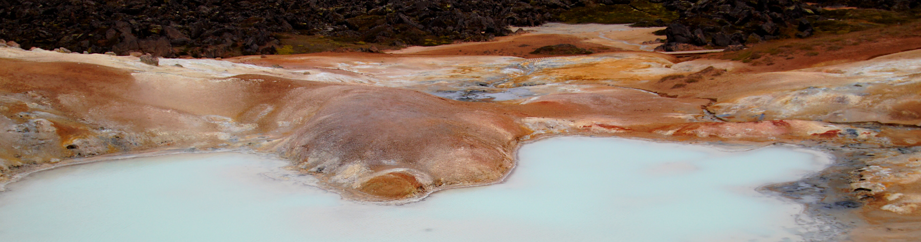
Leirhnjukur

But before I continue with my impressions of Leirhnjukur, please let me give you an idea where you can find it on the map. Leirhnjukur is located in the north eastern part of Iceland. It is about 6 hours / 490 kilometres drive north east of Reykjavik according to maps, but for us driven took more time than was indicated.
location on the map: 65.71956, -17.90429
Another important thing is to ensure to have a filled gas tank because distances are long here and gas stations are few and far between in this area.
Autumn colours of Ásbyrgi


Botnstjörn


Reflections in Botnstjörn pond

Leirhnjukur


Iceland is one of the most geologically active places on Earth having had regular volcano eruptions during the past century. And at Leirhnjukur, being one of the High Temperature Areas in Iceland, you can unmistakenly wittness a tiny bit of this constant geological activity.
At Leirhnjukur we are on top of the Mid-Atlantic Ridge; the boundary where the North American and Eurasian tectonic plates meet and separate. The ridge is about 16,000 km long, and reaches all the way from 87°N (about 333 km south of the North Pole) to subantarctic Bourvet island at 54°S. The Atlantic Ridge is also part of the longest and the most extensive chain of mountains on earth, extending continuously across the oceans floors for a total distance of 40,389 km.
Most of the Atlantic Ridge is hidden under water however, and with that, more than 90% of it is hidden from view. But here on Iceland it is not just hidden in the ocean; the Mid-Atlantic Ridge is clearly present and noticable. Especially here in the Myvatn region.
The Mid-Atlantic Ridge is responsible for the volcanic activity which created Iceland, and the island appeared over the ocean surface about 16 to 18 million years ago. But the Mid-Atlantic Ridge still has a constant impact Iceland, changing its geography. Iceland is in fact still growing from fresh volcanic eruptions and the moving of the tectonic plates.


Simone & Åke, September 2020, Leirhnjukur, Iceland

It would be great to hear from you!
You can reach me by sending me an Email.
Or leave a comment / reaction in the box below.
You can also follow me on Facebook: Sim1 around the World Blog
:-) Simone