| My pages about Italy |
| Abbey of Sant'Antimo | |||
| Burano | |||
| Carsulae | |||
| Meeting spring in Pienza | |||
| Venice | |||

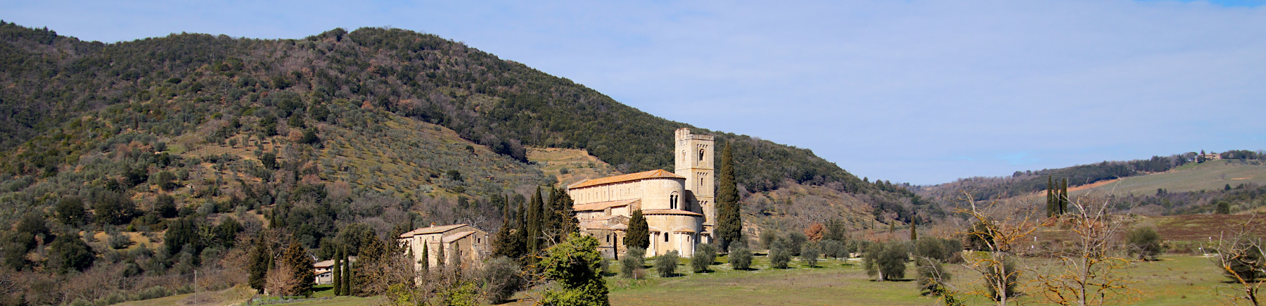
Abbey of Sant'Antimo
For now this page will be a sort of photo collage, but hopefully some day soon I will have some time to write a bit more in depth about my visit to Abbey of Sant'Antimo.
All the photos in the collage below are clickable, so you can view the larger photo.
Abbey of Sant'Antimo
Italy

xxx


We have an app on our phone that records our walks, which is quite fun (the App is called Komoot). The map on the left side is our recorded walk.
If you want to do the exact same hike as we did, you can find the link here: https://www.komoot.com/tour/702812431?ref=wtd
Starting point: Park close to the gate of Castelnuovo dell'Abate
GPS starting point: N42.9941601, E11.5159534 (click to open coordinates on google maps)
Type: loop trail
length: 3,25 km.
total height difference: 90 m
Trail signs:none
Difficulties:


Simone & Åke, March 2022, Abbey of Sant'Antimo, Italy

It would be great to hear from you!
You can reach me by sending me an Email
:-) Simone