| My pages about New Zealand |
| My travel stories | My photo impressions | ||
| The Clay Cliffs of Omarama | Akaroa & the Banks Peninsula | ||
| Hooker Valley Trail | |||
| Takahē birds at Te Anau | |||
| Tongariro National Park |

For now this page will be a sort of photo collage, but hopefully some day soon I will have some time to write a bit more in depth about my visit to Akaroa & the Banks Peninsula
Akaroa & the Banks Peninsula
New Zealand

Akaroa & the Banks Peninsula
Akaroa


Purau Bay


Port Levy: Locality (sometimes known as Koukourarata) 14 km south-east of Lyttelton


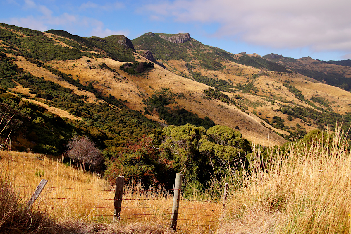
Gorgeous Banks Peninsula (Horomaka) was formed by two giant volcanic eruptions about eight million years ago. Harbours and bays radiate out from the peninsula’s centre, giving it an unusual cogwheel shape. The historic town of Akaroa, 80km from Christchurch, is a highlight, as is the absurdly beautiful drive along Summit Rd around the edge of one of the original craters. It's also worth exploring the little bays that dot the peninsula's perimeter.
The peninsula is composed of various ancient volcanoes. Over several million years, eruptions and erosion in the volcanic complex carved the picturesque valleys, tumbling hills, verdant pastures and punctuating bays that we see today.


Akaroa is the Canterbury region’s oldest town and was founded in 1840 by French settlers. It is believed that French interest in the area propelled the English to speed up its annexation of New Zealand. By the time French settlers arrived, the signing of the Treaty of Waitangi has taken place, thus cementing the country’s place as a British colony. To this day, the British-French duality is evident throughout the township, as most of Akaroa’s streets still have French names, providing a contrast to the 19th-century colonial cottages that surround it.


There are two historical churches in Akaroa, the Presbyterian and the Anglican Church. During our stroll through the village we took a look at one of them: St. Peters Anglican Church
ö.l https://www.akaroachurches.co.nz/anglican-history/


Cook concluded that the land he had sighted was an island and named it after the expedition’s botanist, Joseph Banks. The mistake was not realised until 1809, when Captain Samuel Chase of the Pegasus tried to sail between Banks ‘Island’ and the Canterbury mainland. This was one of only two significant errors on the remarkably accurate map of New Zealand Cook made on his first expedition. He was too far from shore to see the low-lying land joining the volcanic peninsula to the mainland. He also made the South Island too narrow because he did not realise how far east the Canterbury Plains extended. But the outline of the South Island is clearly recognisable, and he correctly recorded the main mountains. The Yorkshireman even recorded a Maori name for the South Island, Te Wai Pounamu (as ‘Toai Poonamoo’). Cook’s achievements in charting the South Island were all the more remarkable, given that prevailing winds consistently kept the Endeavour well offshore. Without a chronometer he also struggled to determine his exact longitude. Cook’s second major error was recording Stewart Island as a possible peninsula. To be fair, he thought there was probably a passage between what he mapped as two bays, but he left the chart incomplete. The first chart of what was to become known as Foveaux Strait was produced by American sealer Owen Folger Smith in 1804.
Interestingly, the peninsula’s ragged features famously led Captain James Cook to mistake the area for an entirely separate island. If you ever get the chance to see this majestic setting from up in the skies, you might understand the explorer’s oversight: the sprawling nature of its landmass is quite remarkable.
On that note, there are quite a few walking and hiking routes dotted around the Banks Peninsula. Those with an affinity for multi-day tramping might choose to explore the Te Ara Pataka/Summit Walkway, which connects the Gebbies Pass in the Lyttelton crater to Hilltop in the Akaroa crater. From Hilltop you can also access the Pigeon Bay Walkway – a five-hour hike that will expose you to some of the most spectacular coastal vistas as well as a series of native trees and plant life.


Simone & Åke, February 2017, Akaroa, South Island, New Zealand

It would be great to hear from you!
You can reach me by sending me an Email.
Or leave a comment / reaction in the box below.
You can also follow me on Facebook: Sim1 around the World Blog
:-) Simone